Wyrley Bank Branch Canal
Sneyd
March 2013
If you have persevered through the deprivations of the last mile or so you will be rewarded by a gem - the Sneyd area. To save embarrassment its pronounced Sneed as in feed.
Link to original 2009 series on this canal.
So far our journey south has been on the level with the canal clinging to is 503 ft contour. But now the moment of reckoning. The canal had to drop down to reach the 473 ft Wolverhampton Level which it achieved via a flight of five locks at Sneyd.
In 2013 just the top and bottom locks are visible.
Sneyd top lock
North from Sneyd top
Outline of Sneyd top lock
The entrance to the top lock stands proud in the canal channel, its wings clear of the debris but with its chamber infilled. Over the years the infill has settled to the point that the site of the chamber is very visible and the coping stones are poking through here and there. Click here for a view of how this chamber looked before being filled in.
Vernons Way with reservoir to the right
The site of the second lock down is also visible as a terrace, just before the relatively new Vernons Way access road obliterates the course of the flight down to Sneyd Junction.
I am standing on lock no 4 which looked like this (click)
I am standing on lock no 4 which looked like this (click)
Sneyd Reservoir
Alongside the flight the earth ramparts of the mighty Sneyd Reservoir tower up originally containing a cast volume of water to supply the Wolverhampton level, one of the primary reservoirs of its day.
Sneyd navigable feeder
Pump House outfall
Today the level has been lowered drastically and the residual lake is popular with fishermen, bordered with trees. A veritable oasis. A closer inspection of the eastern side of the reservoir made me stop and ponder what I had taken as the feeder channel. Why was it there and why its chunky dimensions? The conclusion is that this was a navigable channel which allowed boats to reach the highest part of the reservoir and the point where the pump house stood. Basically it was a canal for the delivery of coal to fire the pump engine. A search among the undergrowth reveals substantial oblong edging stones fallen into the channel plus the remains is the inlet channel sloping down through the embankment, large enough for a boy to crawl through but far too small for a 50 years old canal enthusiast who knows better...
Sneyd Bottom Lock
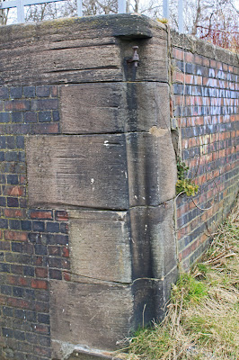
And so to the bottom lock, its cracked bottom end standing proud to the Wyrley and Essington.
The cracking gave me reason to ponder, and the two big flash ponds either side. Closer inspection of the lock revealed massive subsidence at the top end. The top is a good three or four feet lower than the bottom and I conclude that there was a mine directly beneath the top end which has settled taking the canal with it - all this in the last 60 years.
Here is how the bottom lock used to look.
Here is how the bottom lock used to look.


No comments:
Post a Comment