Telford's Tub Boat Canals
Wombridge Canal - Trench to Wombridge
January 2012
Other posts in this series:
1. Trench to Wombridge (this post)
2. Trench to Donnington Wood Mill / Church Road
3. Church Road to Wrockwardine Inclined Plane

The Wombridge Canal
Other posts in this series:
1. Trench to Wombridge (this post)
2. Wombridge to Church Road
3. Church Road to Donnington Wood
It could be argued that this next section is a continuation of the Shrewsbury Canal, as that is the name it traded under till it was closed and de-watered in 1921. However, it has an older pedigree and, for the purpose of this series, I will take a look at it as it was originally built by William Reynolds in 1788 to move ironstone and coal to the furnaces at Donnington Wood.

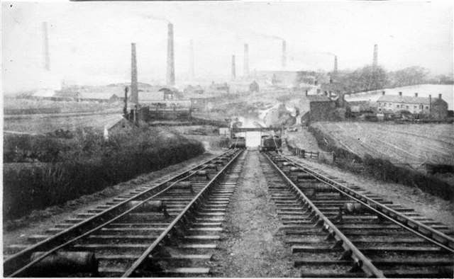
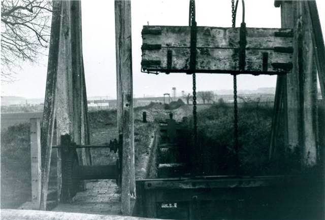
Top of Trench Inclined Plane
This sale of one mile of track to the Shrewsbury Canal was a smart move as it recouped over half of his construction costs at a time when the mines and quarries it served were largely played out. Following the sale of the section to the north of Trench the remaining 0.75 of a mile deteriorated and navigation retreated in stages. By 1902 there was nothing much left and its course is only visible as a series of disconnected ponds.


Wombridge Canal 1902
Fast forward to 2012 and what remains? Past accounts suggest not a lot, but undaunted we struck off to the south west from the top of the Trench Inclined Plane, one of the three fixed known points where the canal passed.
.jpg)
.jpg)
Wombridge Arm 2012
Straight off we struck pay-dirt. There, exactly as shown on the Godfrey map, was a 20 foot wide shallow trench in a row of old trees. This is not to be confused with the deeper valley between the top of the plane and the colliery spoil heap behind it. Sure, it looks promising but that canal like swathe of open grass swings round on the wrong direction and the levels go to pot. The key is to stick to the 100 metre contour.

Canal route to Wombridge Road
Then its a leap of faith as the course spans a cutting excavated to build the modern Wrockwardine Wood Way. Picking it up again at the far side is tricky, but a gap on the houses exists in just the right place on Wombridge Road with the curving line of the canal reappearing behind Laburnum Road.

Route to rear of Laburnum Road
A footpath follows the route to an underpass beneath the A442 Queensway. This is the second known point on the route, the point where the canal passed under the railway which rapidly rendered it obsolete. The railway has been replaced by a road but the crossing remains, pretty much at the same height.


Site of route under railway
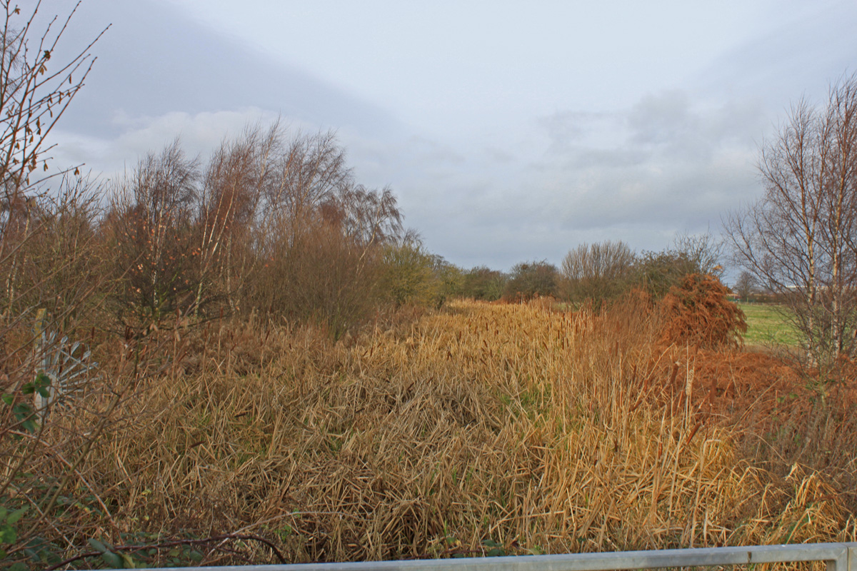
From here the canal emerges into a large open area, and used to curve round to the east hugging the contour and avoiding the low lying Wombridge Pool. All traces of the canal have vanished and its route passes through today's football pitch. The only trace of the canal is an excess of clay underfoot.

Open space which contained the loop in Womborne
The line then continues beneath the modern Bollingale Avenue, coming to a conclusion somewhere close to its junction with Abbey Walls. As far as we can tell that is the end of the arm, just south west of Wombridge Church. It may have extended to Wombridge Rd and the quarry beyond, but that is pure speculation.
Update 7.2.12 - I love the way people drop in little snippits of interest not found elsewhere. In this case I now discover that the canal did continue right up to the Wombridge Road but within a tunnel which accounts for the inconsistent ground levels and the route appears to follows the line of the ponds on the 1912 map. See Pascals following account of the tunnels in the 1960's.
The canal tunnel was accessible in the 1960's, during the time of the demolition of the farm, 1967, a small portion of the roof collapsed just inside the Farm perimeter wall. As children three of us explored this tunnel in both directions - northerly took you almost up to the Wombridge road - the other direction taken you back along the farmfield for about thirty or forty feet. the canal by then had been partially filled in with soil & rubble however we were able to stand up inside the tunnel whilst exploring (we were around 9 to 11 years old at the time so no more than 5 foot tall).

The line of the tunnel is not as you have pictured, to the right of Bollingal Avenue, but nearer Wombridge Road; The end house of Priory road had a plot of land adjacent to it which was almost opposite the roof cave in. You can see this site on Google Earth by the difference in the housebuild - all the houses along the road have garages built in apart from the two newer ones.
Update 7.2.12 - I love the way people drop in little snippits of interest not found elsewhere. In this case I now discover that the canal did continue right up to the Wombridge Road but within a tunnel which accounts for the inconsistent ground levels and the route appears to follows the line of the ponds on the 1912 map. See Pascals following account of the tunnels in the 1960's.
The canal tunnel was accessible in the 1960's, during the time of the demolition of the farm, 1967, a small portion of the roof collapsed just inside the Farm perimeter wall. As children three of us explored this tunnel in both directions - northerly took you almost up to the Wombridge road - the other direction taken you back along the farmfield for about thirty or forty feet. the canal by then had been partially filled in with soil & rubble however we were able to stand up inside the tunnel whilst exploring (we were around 9 to 11 years old at the time so no more than 5 foot tall).
The line of the tunnel is not as you have pictured, to the right of Bollingal Avenue, but nearer Wombridge Road; The end house of Priory road had a plot of land adjacent to it which was almost opposite the roof cave in. You can see this site on Google Earth by the difference in the housebuild - all the houses along the road have garages built in apart from the two newer ones.
So, living proof that a tunnel did exist, probably running from Wombridge Road pretty well back to the open ground. One would therefore assume that it emerged on the far side of Wombridge into the site of the old furnaces the canal was built to supply. Hmm, I feel another version of the map coming on.

(not the) Terminus at Bollingale Avenue
So, not many physical traces after 150 years of abandonment, but enough clues to accurately trace its line through the contemporary streets of Telford.
The above photos have been assembled from various sources, including those freely found on the internet. My thanks go to the many photographers alive and dead who have contributed to this collection and in so doing, are keeping the memory of these canals alive. These images are reproduced for ease of research are are not necessarily the property of this blog and some may still be subject to copyright, and as such they should not be used for commercial gain without the explicit permission of the owner (whoever that may be).


.jpeg)