Saturday 21 December 2019

Exploring the Anson Branch Canal

Anson Branch Canal - BCN
December 2019

I have been out and about again with my Go Pro, this time exploring the line of the abandoned Anson Branch Canal. 


Technically, this is a branch  of the Walsall Canal, but as the Bentley linked into and used the last half mile, it seemed appropriate to include it in my hunt for the abandoned branches of the Wyrley and Essington.

It's funny what you turn up in the research for these videos. I figured that this was just another little branch built to reach another coal field but in the event there was much more to this waterway, bisected by the construction of Junction 10 of the M6.

Not only did I find myself looking at the collieries in the Reedswood area of Walsall, I also found myself in a quarry with links to the Giants Causeway and Noddy Holder, plus gaining an understanding of how the canal was an essential element of the mighty Birchills power station which stood on the site of todays Sainsburys.

Link to The  20 minute Anson Branch YouTube video


Saturday 14 December 2019

Exploring Bentley's bottom

Exploring the lower half of the Bentley Canal
December 2019

I have attached a link to the latest Canal Hunter video, this time exploring the lower half of the Bentley Canal.


I can promise that there are no spontaneous bursts of song in this one.....


Saturday 7 December 2019

Exploring the lost Bentley Canal

Bentley Canal in Wednesfield
December 2019

Well, I have finally got cracking on the next series of Canal Hunter, starting off with the elusive upper half of the Bentley Canal and the Neachells Branch.


Bentley top lock

This section has been heavily built over, but thankfully there are lots of photos to fill in the gaps. 

Here is an easy link to the video:

Canal Hunter series three - Bentley Canal (part one)

Click subscribe on the YouTube channel to catch future episodes.

Saturday 30 November 2019

CRT Jottings - Elected Boaters meeting 26th Nov 2019

CRT Jottings - Elected Boaters Meeting 
26 Nov 2019

A meeting between CRT and the Elected Boater Representatives took place last week in Aqua House, Birmingham and the following issues were discussed:

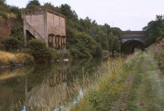
Strong Stream warning system
This on line service is not currently available due to a technical issue which is being addressed. 
The issues with the service are not limited to the current technical problems and it probably true to say that it is more accurately described as a water level indicator, as most measures don't include flow rates. The wording describing the warnings needs to be changed to better reflect what it does and where the data comes from. These feeds include SCADA, Manual input, EA measures plus inconsistent measures from the Kennet and Avon and other non CRT waters such at the Warwickshire Avon.

A single, consistent nationwide system is needed.

There is also inconsistency between the on line measures and the bankside boards where canals meet rivers.

The priority is to resolve the on line offering which can be done quickly and at minimal cost. Changes to the "in the field" hardware have budget implications and will will be considered alongside other asset requirements.

Election Update (CRT National Council)

The invitation for National Council nominees has resulted in a larger number or candidates than four years ago.

There are:
5 nominees for the two Business Boating seats
34 nominees for the four Private Boating seats.

The election process is detailed on CRT's website.

After election an integration programme will be deployed to bring the new representatives up to speed as quickly as possible.

There was concern that the nominees may not all appreciate what is expected of them beyond the 2 annual National Council meetings. It was suggested that in future an explanation paper should be issues to all individuals submitting an application, giving a detailed insight into what role is and entails before the closing date for withdrawal is reached - helping candidates make informed decisions.

Boater Survey update

The main annual boaters survey issued in Feb / March to 1/3 of license holders is now being supplemented by bi weekly surveys issued to 2500 licence holders triggered by boat sightings. These requests deliver approx 300 results every 2 weeks, and this supplementary research work generates near real time insights month by month. Because it is based on boat movements recorded it delivers opinions of travelling boats rather than those of moorers.

The overall satisfaction levels in the main annual survey had dropped to 62% (from 71%) but the additional feedback showed this score rising from 64% in April to a rolling average of 67% in September.

The key issues raised are facilities, non compliant boats, dredging and overhanging towpath vegetation.

I small Hire Boaters survey has been undertaken and the results will be circulated in the near future.

Overall the North, Wales and East Midlands are rated the highest.

Most respondees had visited CRT's website and 65% found it easy to use.

Key take away was that movers were more satisfied than those that don't move much. Also the levels of satisfaction were improving over the summer.

Wide-beam issues

There have been seven unbooked wide-beam passages through Blisworth Tunnel this summer. This is in contravention to license T&C's and represents a very significant H&S risk. There is also concern that some craft with excessive air draft may damage tunnels and bridges. The plan is to feed such passages into the license renewal approval process.

There was discussion about adding movable width restrictors at the ends of the tunnel, but given the levels of non compliant passages a retrospective warning system is preferred.

Wide- beam mooring can also be an issue and inconsiderate mooring on some bends,  and a suitable approach to apply penalties is being considered.

Three Words positioning application

This application is becoming more widely used to pinpoint individuals locations. CRT's call centre staff have this system available and a comms is being developed to raise awareness.

Water Point compliance

The need for various adaptations to public CRT water points was raised including insulation and non return valves. More stringent anti back syphon rules apply to taps near Elsan / pump out points.

CRT will take this potential away and consider what action may need to be built into their facilities programme.

Emissions issue

Feedback has been sought re the level of impact the proposed changes will have. So far CRT have 400 responses and these will be collated and submitted to the Government in Jan 2020.

Next Meeting is in February 2020.

Canal Hunter Series Three starts

Canal Hunter - Series Three Introduction and the Slough Arm
November 2019

For those of you that don't already subscribe to my YouTube channel "Life at 2.3 Miles per Hour", I have started a new series hunting for the lost sections of is Birmingham Canal Navigations. 

This season I will be looking for the remains off the Wyrley and Essington Canal, and my plan is to publish and episode each Saturday till we reach the bottom of Ogley Locks near Lichfield.

That should keep me busy for most of the winter!

Click here for Series Three, Episode One - Introduction and The Slough Arm.

Happy watching!

Saturday 23 November 2019

CRT's National Council Elections

CRT's National Council Elections
November 2019

CRT will soon be holding elections for seats on their National Council.


The names of those standing will be published on 25th November and voting will take place on line between 20th Jan and 14th Feb 2020.

All 12 month license holders on CRT's books as at 19th Sept will be eligible to cast a vote.

I have represented Business Boating for the last four years I can confirm that I will be standing for re-election. However, because the 500 Roving Traders have now been included in the Private Boating constituency, I will this time be seeking votes from the wider combined Private Boating and Roving Trader community.

The election pages limit me to a manifesto of just 200 words so, to supplement this, I have produced a short YouTube video explaining the role of the National Council and why I am standing for re-election for a further four years.

Click on this link to take you straight to my video.

I would be grateful if you would 1. share this around the various on line forums to spread the word and 2. vote for me when the time comes.

Many thanks.


Friday 22 November 2019

Exploring the Aylsham Navgation

Canoe trip down the Aylsham Navigation
November 2019


I spent much of my adolescence messing about on the River Bure near my home village of Coltishall in Norfolk. If I wasn't swimming in it I was fishing, sailing or canoeing. 

One way or another I always seemed to find myself somewhere near the river, and often on the reaches above Coltishall Lock which comprised the Aylsham Navigation, before it was washed out in a huge flood in 1912.

I have always fancied making a canoe trip along the old navigation and a few weeks ago I have the opportunity to do just that, accompanied by my son Dan.

We sent a day travelling from Aylsham to Coltishall in a canoe rented from The Canoe Man, taking advantage in a small window of opportunity when the river level subsided enough to make the passage possible.

I took my trusty GoPro with me and made thee videos of the trip into which I have woven an account of its history, along with my recollections of life on the river in the 1970's.

For those of you without a YouTube account her are three links to the videos:


Wednesday 20 November 2019

An apology!

What happened to all the comments?
November 2019

I had been coming to the conclusion that blogging isn't what it used to be.

The number of visitors to the Capt Ahab site have kept climbing over the years, but I was more than a little mystified why the comments had stopped. I was increasingly of the opinion that I was writing into a vacuum - because no one ever said anything in reply.

But then this morning, at 4.30am when I couldn't sleep, I was idly adding something to the blog when I started clicking on the buttons relating to unmoderated comments. Imagine my shock when there were literally hundreds of unpublished comments.....

I used to rely on a notification e-mail from Blogger that a comment was awaiting moderation, but somehow this function was turned off about 18 months ago. So, I offer a heartfelt apology to all of you have left a comment and been puzzled why I had never replied.

The system is working now and I will regularly check the unmoderated comments button in future. Please don't think I was being rude - I love to get comments, especially those that add historical snippets to my posts.

If you ask me "did you switch the e-mail notification system off?" my reply will have to be "no comment"!

Monday 18 November 2019

To Venice by train

Birmingham to Venice by train
November 2019

On Nov 4th, the 250th anniversary of the completion of the Birmingham Canal, we set off on a European train journey which ended in Venice, Europe's second canal city.


I made a Canal Hunter video of the trip which will appeal to those that like canals, Venice and rail travel.

For those without a YouTube account - here is a link to a bit of light relief in the midst of all the electioneering.

Wednesday 13 November 2019

The Avery Loop - Main Line

The Avery Loop - Main Line


I have never been entirely sure what to call the last lost loop just before Smethwick Junction. For the sake of a better name I have always referred to it as the Avery Loop, a loop of canal created by the construction of the New Mainline Canal which looped round the old Avery Works, a contemporary of Matthew Bolton's Soho Manufactory


The northern entrance bridge reads into a basin dug by Avery's in 1936 and is at a slight angle outside the original line of the loop canal.

The complete line of the loop in 1937

Soho Foundry with basin covering Avery Loop - Keith Hodgkins


Immediately opposite, near Rabone Lane there is another blocked up canal arch which is framed by yet another rise and fall in the towpath and backed by modern factory building on Steelbright Road.


1974 View from near Rabone Lane towards the Avery Arm (Hugh Potter)

Entrance to Avery Loop south 1973 Hugh Potter

Northern entrance to Avery Loop 1973 - Hugh Potter

Avery Loop northern end at Soho Foundry 1890 - Birmingham Archive


The Soho Foundry Wharf - Keith Hodgkins


1936 as the Soho Foundry Basin was filled in - Keith Hodgkins

Among Hugh Potter's photos of the area taken in the early 1970's, there is one image taken from behind the wall and looking across the canal towards the site if the Avery Works and the site of the Soho Foundary, with the distinctive chimney and stepped wall still visible.


The southern entrance in 1937 (foreground)


Just to the north of the Avery Loop is Rabone Bridge and the start of the lost Rabones Loop, accessing the Cornwall Works. This was another shallow loop to the east of the mainline canal which is now completely built, over but even in the mid 20th century it remained navigable and was referred to by the boatmen as "Tangy's Hole" accessing the works of Walton and Browns. This loop had no towpath and the old coal boats had to be shafted in and out by hand, and the coal shovelled over a wall into the works yard.


Cornwall Works Arm 1930's


Click here to return to the Birmingham to Smethwick area index page


The above


Monday 11 November 2019

Sandwell Coal Chutes

Sandwell Coal Chutes

There is a missing landmark on the Old Mainline in Smethwick, a bit like a missing tooth in a familiar smile.


The landmark I am talking about is the set of canal-side Coal Chutes which were built to transfer coal mines at the nearby Sandwell Park Colliery. This coal arrived by tramway and was dropped into BCN day boats (Joeys) waiting below.


BCNS Archive


These loading chutes towered over the Old Main Line, gradually decaying following the closure of the colliery at the far end of the tramway. Over the years the concrete towers crumbled and ended up in a dangerous condition before they were finally demolished and replaced with an interpretation board.

 An images has emerged from the Hugh Potter collection which provide a great insight into this landmark as it was in 1974, before the decay really set in - another little bit of the BCN's rich jigsaw.

Coopers Coal Wharf in Smethwick - BCNS Archive


Click here to return to the Birmingham to Smethwick index page

The above photos have been assembled from various sources, including those freely found on the internet. My thanks go to the many photographers alive and dead who have contributed to this collection and in so doing, are keeping the memory of these lost canals alive. These images are reproduced for ease of research are are not necessarily the property of this blog, and as such should not be used for commercial gain without the explicit permission of the owner (whoever that may be).

Saturday 9 November 2019

An un-regenerated Engine Arm, BCN

Engine Arm as it was
November 2019

The Engine Arm in Smethwick has been a backwater full of residential boats for decades, but back in 1974 it was all very different. 

Among the Hugh Potter collection of black and white images there are two which reveal this as the abandoned backwater as it used to be. This was back in the day when there was no winding hole at the far end and an expedition along this obscure arm resulted in an awkward and rather long reverse back out again.


If you are unfamiliar with the Engine Arm you may wonder why the BCN went to the bother of erecting such an impressive aqueduct to go....well, nowhere in particular. Truth be told the Engine Arm's has always out-punched its weight, not only serving the various canal side factories but it was also a key feeder for the Wolverhampton Level above Smethwick Locks.


Not only did it receive water from the Titford Pools Reservoir via the Tat Bank Branch, it was also home to a large pumping engine which lifted and recirculated water from the Birmingham Level below.


So that accounts for the need for an aqueduct over the New Main Line, but why so fancy? To be honest I don't really know. It was cast by the rapidly expanding Horsley Iron Works in nearby Tipton, and its my personal belief that the simple metal trough was embellished just to show what they were capable of.

Engine Arm Aqueduct in1974

As usual, if you know differently, leave a comment below.

Thursday 7 November 2019

Chance's Basin

Chance's Basin 


It's not every day that I come across an old photo of something completely new to me on the BCN.

Trawling through Hugh Potter's black and white images from the 1970's, I chanced (pun intended) upon two photos of a basin hidden behind an ancient guillotine gate, a basin I have never seen recorded elsewhere.

The narrative tells me it is a basin which went into Chance's glassworks in Smethwick and with a bit of help from Paul Balmer, this is its location:


Here are the two photos which capture the relic in March 1975:


Guillotine Gate - Hugh Potter 1973


The red arrow is the shed before the roof was removed and the green arrow is the entrance.


This is the basin behind the green arrow taken in 1966 by Martin Leech, after the shed had been removed

For a contemporary context, the entrance used to be on the Smethwick side of Stewards Aqueduct and looks like this:


My thanks to Paul for his assistance in accurately placing these archive photos.

Click here to return to the Birmingham to Smethwick index page

The above photos have been assembled from various sources, including those freely found on the internet. My thanks go to the many photographers alive and dead who have contributed to this collection and in so doing, are keeping the memory of these lost canals alive. These images are reproduced for ease of research are are not necessarily the property of this blog, and as such should not be used for commercial gain without the explicit permission of the owner (whoever that may be).

Tuesday 5 November 2019

Ryders Green Interchange Basins

Ryders Green Interchange Basins
November 2019

Those of you familiar with the BCN will be aware of the large number of railway interchange basins which are dotted around the local canal network.


By the time the railways arrived there was simply no spare space to fit railway tracks into the established canal based infrastructure, and a pragmatic approach was taken instead. Railways were brought in where possible and the loads were then transferred to canal boats for shipment to their final destination. This approach had the added benefit of temporary storage pending unloading.


One of the largest interchange basins exists at the foot of the Ryders Green Locks, but its all so overgrown that it's hard to imagine what it used to look like.


Well perhaps I can help there. Hugh Potter's photos from 1974 include a number of the interchange basins viewed from the bottom lock.


Ian Huselbee 1966

Interchange Basin taken by Bob May (BCNS Archive)

1979 - Trevor Littlewood


Ryders Green Locksscene from the BCNS Archive


Ocker Hill Power Station 1979


The above photos have been assembled from various sources, including those freely found on the internet. My thanks go to the many photographers alive and dead who have contributed to this collection and in so doing, are keeping the memory of these lost canals alive. These images are reproduced for ease of research are are not necessarily the property of this blog, and as such should not be used for commercial gain without the explicit permission of the owner (whoever that may be).

Sunday 3 November 2019

Haines Branch Canal

Haines Branch Canal
November 2019

For many the name Haines will make you think of the car owners manual, an essential workshop guide for all those unreliable cars of the 1970's.

But there is the other Haines, a lost branch canal which exited the Walsall Canal immediately below the Ryders Green locks in the Great Bridge area of the Black Country. 

This short canal runs southwest for nearly a mile to reach the site of various collieries and brickworks, industry which has left a legacy of flooded extraction pits now known as the Balancing Lake in the Sheepwash Urban Park.

A surprising number of photos have been found of this reclusive waterway, mainly of the first half as far as Sheepwash Bridge. This will be because right into the 1960's boats carrying wood were making regular deliveries to Thomas Cox and Son Timberyard, and the sight of narrowboats plying their trade in something other than coal seems to have been something of a magnet for photographers.


Aerial view of the junction with the Walsall Canal

Haines Branch Canal into what is now the Sheepwash Park

Entrance to Haines Branch

Haines Branch entrance and Ryders Green Bottom Lock - Arthur Watts 1958

Haines Branch Junction opposite Railway Interchange basins

Entrance to the Haines Branch (Left)Arthur Watts 1957

Haines Branch entrance (right) with Ryders Green Locks ahead.

Bridge over Haines Branch - Alan Price 1969


Boats sunk at entrance to Haines Branch


Two views of the Haines Branch into Great Bridge

Start of Haines Branch at Great Bridge (bottom right)


Great Bridge 1972 by Keith Hodgkins

Great Bridge Bridge from the Laurence Hogg slide collection

Great Bridge

Great Bridge 1979 (Keith Hodgkins)


Great Bridge 1979 - Trevor Littlewood

Great Bridge 1979 - Trevor Littlewood 

Laurence Hogg slide collection

The Haines Branch at Great Bridge in 1974

Great Bridge 1979 (Keith Hodgkins)

Great Bridge Bridge from the Laurence Hogg slide collection


Cox timber yard

Thomas Cox and Son 1916


Boat trip setting off from Cox's timber yard (John Whitehouse collection)


Cox's timber yard by Alan Price / David Wilson

Haines Branch Cox Timber Yard 1969 - Alan Price


Coleshill and Cygnus on the Haines Branch - Alan Price / David Wilson


Cox's Timber yard by Alan Price / David Wilson

Slightly sharper cropped version of above

Haines Branch and Sheepwash Bridge 1969 when trade had ended - Alan Price

Cox's timber yard 1966 by Alan Price

The old Sheepwash Lane / Tame Road Bridge, Great Bridge

Sheepwash Bridge 1983 (Keith Hodgkins)

Canal Channel under Sheepwash Bridge 1983 (Keith Hodgkins)

Site of Brckworks Basin to the west of Sheepwash Basin - Source Ian Huselbee

Ruins of brickworks to west of Sheepwash Bridge - Source Ian Huselbee

The Flooded end of the Haines Branch (Old claypit and now Sheepwash Park)

Western End 1950

Planned incline from Haines Branch to NML (CRT Archive)


Plans for the Birchills Incline (CRT Archive)


The above photos have been assembled from various sources, including those freely found on the internet. My thanks go to the many photographers alive and dead who have contributed to this collection and in so doing, are keeping the memory of these lost canals alive. These images are reproduced for ease of research are are not necessarily the property of this blog, and as such should not be used for commercial gain without the explicit permission of the owner (whoever that may be).