Showing posts with label BCN. Show all posts

Saturday, 10 December 2022

Monway Branch

December 2022

The Monway Branch has to be one of the most obscure lost branches of the BCN, built to service heavy industry of Wednedbury to the east of the Walsall Canal between the better known (but also lost) Gospel Oak and Bradley Locks branches.

This "L" shaped branch was about 3/4 mile in length and its construction was approved in Parliament in 1783, at the same time as the Ryders Green extension of the old Birmingham Canal to reach the collieries of Broadwaters (later becoming the Walsall Canal) but economic uncertainty delayed construction till 1812.

The area was very prosperous for several decades with the surrounding land being used for heavy industry till the depression arrived in the late 1870's. 

After clearance of the first wave of industry on the site the Patent Shaft Works was built in the 1950's and became the most significant business on its banks. The branch canal became less relevant over the years till finally just the entrance bridge remained during Hugh Potter's visit in the early 1970's.

These days the only echo of the branch and its industry is the name of the main road through the area - The Patent Shaft Way.

Fortunately a few photos have emerged which capture this backwater, if not in its heyday then at least in its decline!

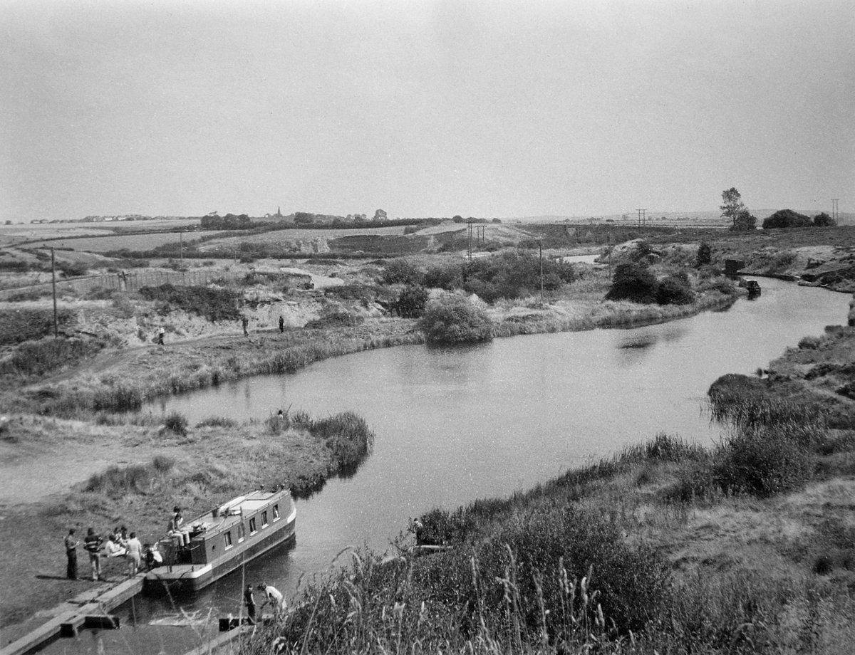
Monway Branch entrance in about 1973 Hugh Potter

A. new Railway Bridge over the Monway Branch in 1958 Mark Hooper

Into the works in 1956 from Railway Bridge Mark Hooper

The "back arm" from the air

Patent Shaft works on the Monway Branch 1959 - Mark Hooper


The complete Monway network

Patent Shaft site 1956 with Ocker Hill Power Station in the gloom beyond - Mark Hooper

The "Back Arm" over the Patent Shaft site 1956 Mark Hooper

Patent Shaft and Axletree Works on the Monway Branch

The Monway site in operation in the late 1950's


Slightly off the Monday Branch but with the chimneys of Patent Shaft in the background if this good shot of Round's scrapyard near Leabrook Road Bridge with a Cadbury's steam shunting engine in the middle - see press article for the story.

Rounds Scrapyard on the Walsall Canal early 1960's  Source RCHS Ian Husselbee


The above photos have been assembled from various sources, including those freely found on the internet. My thanks go to the many photographers alive and dead who have contributed to this collection and in so doing, are keeping the memory of these lost canals alive. These images are reproduced for ease of research are are not necessarily the property of this blog, and as such should not be used for commercial gain without the explicit permission of the owner (whoever that may be).

Saturday, 30 May 2020

Anglesey Basin

Anglesey Branch and Walsall Wood


Strictly speaking Anglesey Basin remains navigable, but the short branch from Catshill Junction in Brownhills has such a rich lost heritage I cant resist including a page dedicated to images of the old coal loading infrastructure.

The channel was first built in 1800 to carry water from what is now known the Chasewater Reservoir to the Wyrley and Essington Canal. Later in 1850 the channel was enlarged to full navigable dimensions to facilitate access to the new collieries being sunk in the lee of the reservoir dam wall.


The coal trade continued from this wharf to the very end of canal carrying, only coming to an end in 1967.


1955 - Stan Heaton


Robert Aickman photo

Salvation Army Sunday School Outing to Norton Pool (Chasewater) in the 1940's

Before the construction of the M6 Toll this was a magical place to moor but these days the combined rumble of the M6 Toll and its cousin the A5 are always audible, dispelling some of the mysterious atmosphere which hangs over the site.


Probably the best picture of the 1930's old loading canopy at Anglesey Basin

1960's loading conveyor with Juniper Cottage in background


Robert Aickman view of loading chutes

Coal Chutes 1951

Tug Helen at Anglesey Basin


Aqueduct on Anglesey Branch


The Chasewater Dam valve 1961


Moving coal from Anglesey Basin in the 1950's

Element's Princess Anne returning to Anglesey Basin in 1955 Bob May Collection (BCNS Archive)

Black Cock Bridge - Ian Husselbee (RCHS archive)

Daw End Branch from Lathams Bridge to Northywood Bridge with Empire Brickworks in Aug 1953

Aldridge Brick and Tile Works from Lathams Bridge August 1953

Drone image of the Aldridge Colliery Basin


Breach Gates at Northywood Bridge (aka Horners Bridge) Aldridge 1934 


Coal on Daw End Branch taken from Riddian Bridge in1966: Charlie, Horace and Young Billy Foster carry small coal for GEC Witton on Princess Anne and two joeys

Andy Matthews comments on above image 26.1.25 : 
Charlie on Princess Ann, Horace on the middle joey with Billy steering the trailer, they have just passed under Riddean bridge heading to GEC witton with three loads of slack (very small coal) it would be unloaded by the telfer crane there, PA first with the now empty tug grabbing a couple of empties for the journey back leaving the full joeys in their place.
They were working for T&S Elements at this time, Elements having the contract to supply GEC with boiler coal. They originally loaded at Hednesford and could do 6 trips a week, once the extension closed as a result of subsidence and the open cast works they loaded at Holly bonk or Lane Head basin then finally at Anglesey basin after Lane Head stopped loading.


Peter Keays yard near Browns / Stonehouse Bridge drawn by Edward Padgett-Tomlinson

Keays Yard at Stonehouse Bridge

Longwood top Lock

Charles Foster at Longwood Top Lock 1966 - Source Andy Matthews

Andy Matthews recollections of the above image 26.1.25:

The picture of Longwood top with the lockies vegetable patch on the offside is Charles Foster using a shaft to pull one of the two joeys he was towing behind Princess Anne into the lock, this was repeated at every lock in the flight, man power being used with P.A being locked through the flight first, there were three guys on this trip, Charlie, Horace his son and Young Billy his nephew. 


Alfred Harman - one of the last boatmen in the Russell Branch run


Click here to return to the Small Branches of the Wyrley and Essington index page

The above photos have been assembled from various sources, including those freely found on the internet. My thanks go to the many photographers alive and dead who have contributed to this collection and in so doing, are keeping the memory of these lost canals alive. These images are reproduced for ease of research are are not necessarily the property of this blog, and as such should not be used for commercial gain without the explicit permission of the owner (whoever that may be).

Wednesday, 20 May 2020

Oldbury follow on loops

Oldbury follow on loops

In the same way that we have various loops of canal to the north of Birmingham created by the construction of Telford's New Mainline Canal, the same is also seen in the Oldbury area. In addition to the long Oldbury Loop created by the 1820 shortening programme, there were three further loops to the north, snaking either side of the newly straightened channel.

Immediately to the north of the Oldbury Loop, and on the other side of the new canal, the original line looped around the Globe Brickworks and this remained a full loop till the southern section and the central basin was sold in 1918. 

There followed two more loops heading north, first smaller one linked into Hunts works on the west and then the old line crossed the new canal to the east into the site of Brades Colliery.

Whilst the central sections of these loops were eventually built over, the stub ends were generally retained as loading basins for the canal side industries. In may cases the lines of the old loop canals was reflected in the of the orientation of the new buildings erected.


The original line north of the Oldbury Loop

The Globe Brickworks (top) and the Rounds Green loops (middle)

Third and final loop (top) into Brades Colliery

Tividale Aqueduct with industry - BCNS Archive


The above photos have been assembled from various sources, including those freely found on the internet. My thanks go to the many photographers alive and dead who have contributed to this collection and in so doing, are keeping the memory of these lost canals alive. These images are reproduced for ease of research are are not necessarily the property of this blog, and as such should not be used for commercial gain without the explicit permission of the owner (whoever that may be).