Nottingham Canal
Shilo Way Bridge A6096
March 2010
The lowered A6096 bridge marked the end of our exploration, about three and a half miles from Trowell and half way to Langley Mill.
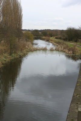
View south from Shilo (A6096) Bridge
This final stretch was once again in water, and this time at full depth. The source of the water supply was unclear but it probably feeds in from the small stream entering at the end of a short basin which branches off to the east. This area was an eara marked on the 1791 map as being rich in coal and ironstone, industries which were probably served by the inlet.
Basin at Cossall Marsh
It would appear that much of the M1 run off is directed into the disconnected stretches of the canal, the modern feeding the ancient.
A moment's reflection before the return journey
A picturesque end to this expedition, leaving just enough time to sit on the conveniently sited bench, catch our breath and then make a swift return to the Festival Inn, including a detour along the remains of the Robinettes Arm.
The next vist to the area will tackle the northern third, starting at Langley Mill and covering the extensive opencast coal workings at Awsworth. The absence of water, or even a dry trough, will necessitate a gread deal more imagination than was required on the lovingly tended stretch.
Broxtowe Municipal Council, I applaud you for your efforts and commitment to this canal line. It has become a beautiful nature reserve and a tourist destination in its own right. It may not have the spectacle of Ambergate, but it is quite lovely in its own way.


No comments:
Post a Comment