Clarke's Lane to Black Country Spine Road
Bentley Canal
December 2009
Clake's lane to the Black Country Spine Road covers about three quarters of a mile, of which the first half a mile is pleasant open greenway part of which skirts Willenhall Cemetry.


 |
| County Bridge |
 |
| Add caption |
 |
| Site of County Bridge |
C
The route involves a number of shallow (20ft) cuttings which make for a boggy path, arriving first at Farm Bridge and then an embankment which now carries the Wolverhampton Road over the line.
Hopyard Bridge
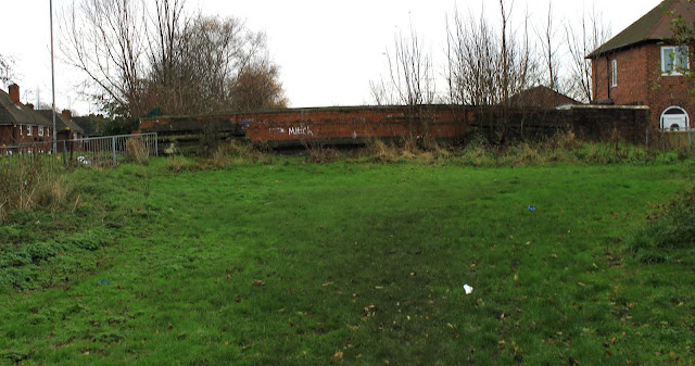
Next up is the crumbling remains of Hopyard Bridge which serves as a barricade to travel along the line, with the ground given over to school playing fields. This school is called County Bridge Primary so I am guessing that another bridge existed in it's vicinity! Eric Richardson suggested that this name belonged to the Wolverhampton Road crossing to the west, but that seems very distant.
East from Hopyard Bridge
With the Black Country Spine road roaring in yours ears you can follow the line along Anson Road to the point where the old Bantley Canal route is emphatically terminated, dangling over the edge of a deep cutting.


Jeff, my expedition supporter


1 comment:
The name County Bridge was originally given to the bridge carrying the Walsall-Willenhall road over a branch of the River Tame. Later it became attached to the whole area including the bridge carrying the same road over the Bentley Canal.
I also understand that the cottage next to the Clarkes Lane bridge was a lock keeper's house.
Post a Comment