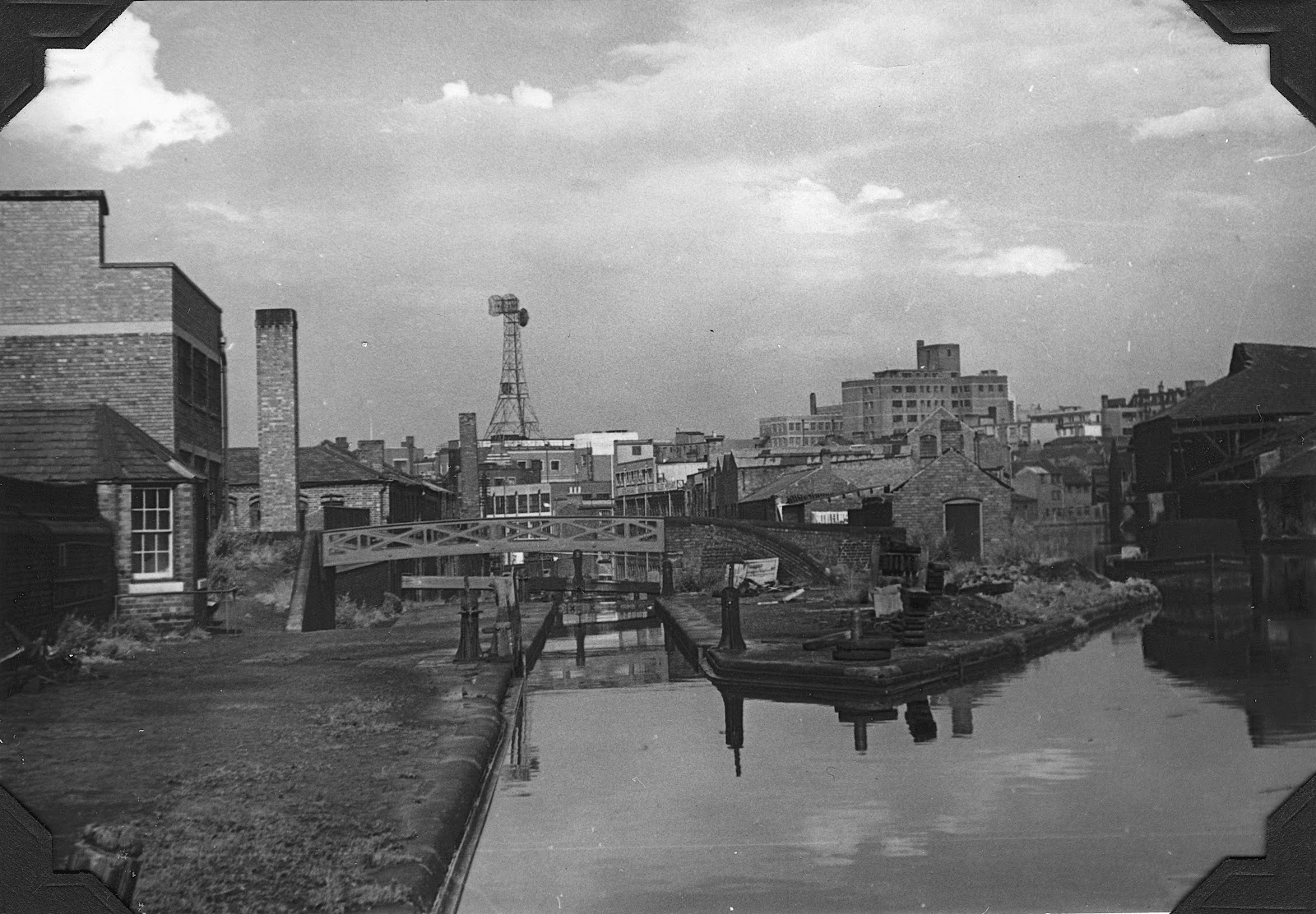
The old Newhall Branch ran east from todays Cambrian Wharf at he top of the Farmers Bridge flight of locks.
It skirted round the foot of the four 1960's tower blocks, round Baskerville Car park and then paralleled Great George St before running out of altitude to the rear of the College of Food.
Aerial view of Newhall Branch (with Gibson's Branch)
View from above showing the Newhall Branch and the foundations of Baskerville House
A closer look at the Newhall Branch
Farmers Bridge top lock with Crescent Wharf beyond
Phyllis Niklin image from 1953 - note the comms pylon which was later replaced by the BT tower

Cambrian Wharf

Cambrian Wharf
The same location in the 1970's
The road roller is in the Newhall Canal bed, curling round an early Baskerville car park.
The Newhall Branch entering its terminus near Gt Charles Street
The above photos have been assembled from various sources, including those freely found on the internet. My thanks go to the many photographers alive and dead who have contributed to this collection and in so doing, are keeping the memory of these lost canals alive. These images are reproduced for ease of research are are not necessarily the property of this blog, and as such should not be used for commercial gain without the explicit permission of the owner (whoever that may be).


No comments:
Post a Comment