Saturday, 31 July 2010

Paused at Thrupp

Thupp
31st July 2010

It's perverse that my only blog post is when I am temporarily back on dry land, mid way on our trip to London via the Oxford Canal and the Thames.

What with a fairly challenging cruising schedule and teenagers wanting DVD's in the evenings there isn't much time for anything apart from keeping on top of my photos. Something has to give and in this case it's the blog. But that's OK, I enjoy writing up the trip records after the event and the process is all part of the experience, so you can expect some proper posts when we get back in a week or so.

Boots watching from the towpath

Bones very kindly offered us the use of her mooring in Thrupp whilst we do a "teenager shuffle" swapping them over between their different summer holiday activities. Today it was Tilly back to the Midlands and returning to Thrupp with Jeff tomorrow - at least we get some washing done overnight.


Maffi at The Boat

Without stealing my own thunder, I would mention a particularly enjoyable evening with Bones, Maffi and Boots. Our schedule went all to pot as we followed some new crews on Oxfordshire Narrowboats, so Bones wisked Belle and Tilly away to a thespian experience leaving  Maffi, Boots and myself to bring Wand'ring Bark down to Thrupp.


Crew of nb Harnser

After an 8.30pm arrival we made for The Boat, where live entertainment was in progress. We meet up with Bones, Maffi and Boots (who slept under the table) and also Brian and Diana, the crew of nb Harnser

Wednesday, 28 July 2010

Update from Captain Ahab

Hi
Just to let you know that Captain Ahab has not been sucked into a watery vortex or anything like that!

We are away on Wand'ring Bark on our way to Oxford, seeing Bones and Maffi along the way. I have got the Dongle to work but only on Belle's computer but all my photos are on mine. Technical solutions are available but not the time!

In the imortal words of Arnold Schwartzenegger - I'll be back.

Saturday, 24 July 2010

Aylsham (River Bure) Centenary

Centenary celebration of the closure of the River Bure     
July 2010
 
Given my interest in the Aylsham Navigation which follows the course of the upper Bure from my childhood home in Coltishall to Aylsham in North Norfolk, a forthcoming celebration ro rival the Olympic Games in 2012 has been brought to my attention.

Stu Wilson is the catalyst for some form of comemorative event to mark the closure of the navigation on 26th August 1912, the day of the great flood. I think every village has a record of "a great flood" but this one was very real and washed away all the locks leaving one wherry stranded half way up.

They are looking for enthusiasts to get involved and make this happen.

This waterway is ripe for restoration with few blockages, loads of water,  just some missing locks. So if you fancy raising the profile of this navigation drop Stu Wilson a line as detailed below.


Hello,
 
I have written to you all before about my idea of commemorating the 100th anniversary of the Aylsham Navigations closure which is on August 26th 2012. For a succesful event we need to start planning very soon. I'm very pleased to say that Aylsham Town Council at their meeting last evening backed this proposal in principle and so it is now time to move to the next step.
 
At some point in September of this year I will call a meeting to discuss this idea to be held at Aylsham Town Hall. I have already had a lot of positive feedback and some good ideas of ways in which we can commemorate this important event in our local history. There is no reason why we have to limit ourselves to one event, indeed we can undetake research and also have fun in some way. It's all up for discussion. The hope is that at the September meeting we can form a working party to drive this forward. However I am keen, as I'm sure you are, that this proposal gets as wider a base of support and participation as possible. For this reason, before setting up the meeting, I invite you to consider any organisations or individuals in your communities and sphere who may wish to be involved. Feel free to forward this email to them but please ask if they wish to be involved they should email me with their details so i can include them in the meeting invite.
 
 
Once again, thank you.
 
Regards
 
Stu Wilson

01603 279510
07867 527682

Thursday, 22 July 2010

Fens Branch Canal - eastern section

Fens Branch Canal
Eastern section
July 2010

My trip to Stourbridge to clear Pennywort from the Fens Branch offered an opportunity to take a look at this previously unexplored bit of the BCN.

Himley Colliery wharf

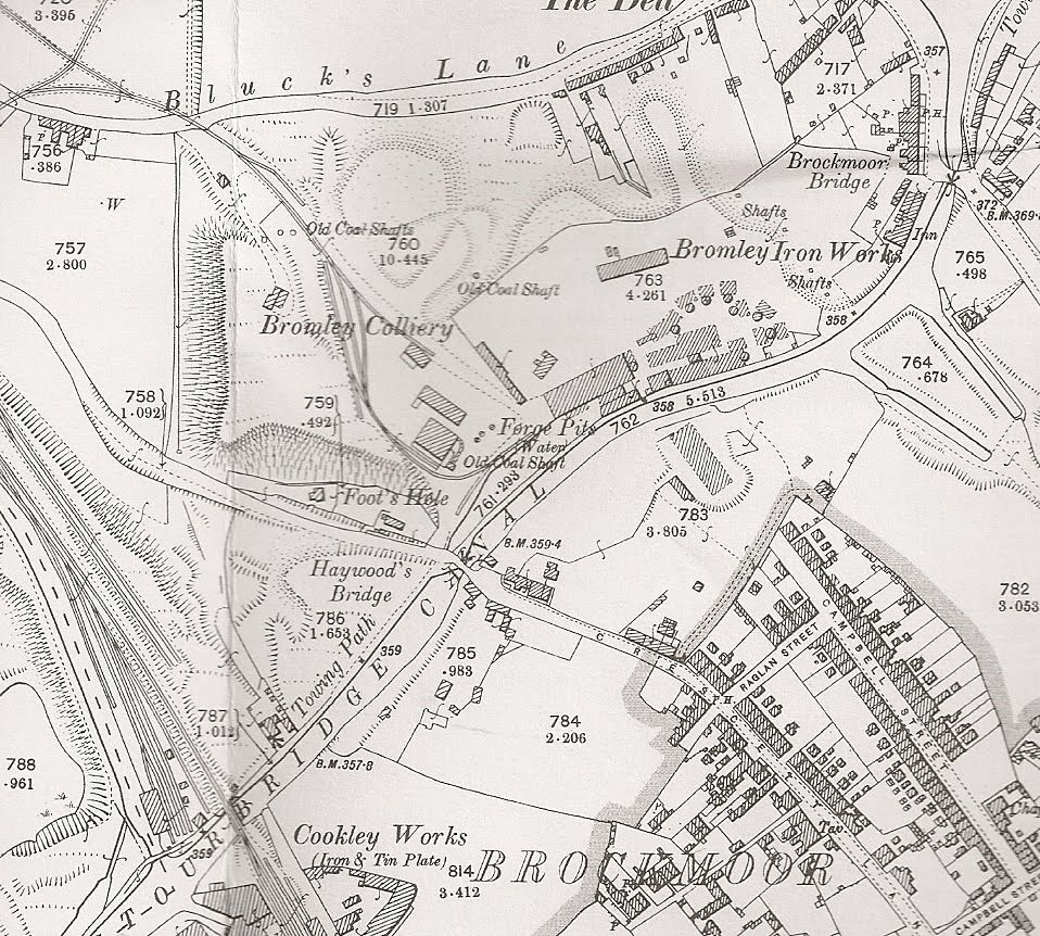
Anticipating a trip or two to the area I had already bought a copy of The Godfrey Edition of the 1901 OS Map covering Brockmoor, which provides some great historical perspective.

My last post covered the section from Brockmoor Junction with the Stourbridge Extension Canal to the now demolished Brockmoor Bridge, but there is more to look at on the other side of the Pensnett Road, a lot more.

Fens Branch terminus basin

The thing to remember about this canal is that it was built to serve the coal industry and there are no less than 14 pits within a one mile radius. A look at the 1902 map reveals a myriad of tailings criss crossed by a network of disused tramways - all leading down to a huge canal basin. This is like a narrow canal on anabolic steroids, it's really broad with an extra wide section at the very start pressing into the pithead of Himley Colliery.

Grove pool

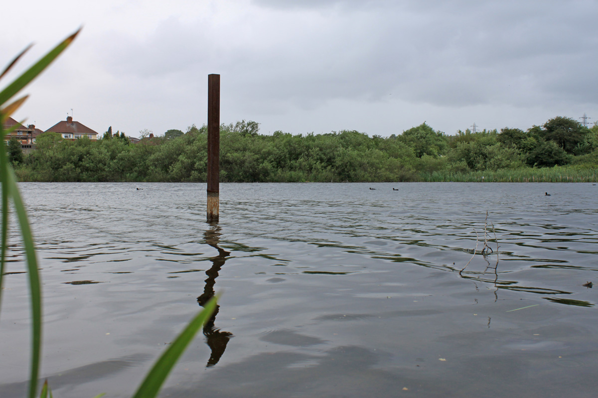
This big basin remains in water, connected to the rest of the canal by a narrow pipe and frequented by fishermen. It's the presence of water that takes me to the final interesting feature of this abandoned waterway. The Fens Branch leads to Grove Pool, a big reservoir built as a canal feeder. The canal ends beneath the high earthen ramparts of the dam holding back the waters of this lake. Sure, its not as deep as it once was, the overflow runs out about 15 feet below its old top, but its still a big expanse of water and provides a steady trickle of water into the Fens Branch, which is what keeps it in water and nearly weed free.


If you look at a  contemporary map you will see two more lakes above Grove Pool, but these are modern affectations created out of the sunken remains of Himley Colliery,  so have no place in this post!


So that brings us to the end of the diminutive Fens Branch Canal, short but satisfyingly in water. More importantly, this serves as a bridgehead to a whole new area for exploration, so maybe I will give Tipton a break for a while and take a closer looks at the lost waterways  to the west of the Dudley / Netherton tunnels.

Tuesday, 20 July 2010

Fens Branch Canal - Stourbridge

Fens Branch Canal
Western end
July 2010

The Fens Branch is a short arm just above the Stourbridge 16 locks, connecting into the much longer but later Stourbridge Extension Canal (yes, Stourbridge had one just like Cannock, which is a bit confusing!)


Brockmoor Junction

The first half of the Fens branch in not only in water but completely navigable, with some semi secure moorings on the stub arm of the Stourbridge Extension, not that I have ever seen any boats in the area. In fact, weeks can go by without a boat making its way up to Brockmoor Junction so the place is left in peace to the anglers and the American Crayfish who abound above and below the surface.

These posts are devoted to the lost waterways so I will skip over the navigable bit (explore it for yourself next time you are passing) and cut to the abandoned section.

Old Railway Bridge to Haywoods Bridge

Narrowboats are stopped at the Old Railway Bridge, whose rotting timbers have collapsed into the canal bed and rendered it too shallow for navigation. This is a shame because the next 300 yards are deep and obstruction free, right to to Haywoods Bridge on Crescett Lane which is a reconstructed footpath bridge built on top of the original curved abutments. This reach is infested with Floating Pennywort, scourge of the canals. It's an invasive plant which creates a dense floating mattress of weed, obscuring light and killing off all the indigenous plants - a bit like the American Crayfish are doing beneath the surface.

Haywoods Bridge is blocked with rushes, probably growing out of generations of rubbish chucked over its balustrades. This is nothing new as Richard Chester Brown records the same situation in his survey 30 years ago.

Fens Arm next to Bromley Ironworks

This section runs through what were once rich coal seams and hundreds of old mine shafts are noted on the old maps, mines which have all gone and in the main been built over. Beyond Haywoods Bridge this changes and to the north you had the huge Bromley Iron Works, consumers of coal and a major user of the Fens Branch Canal, built in 1779. To the south of the iron works there was a big wharf with a couple if inlets for boats serving yet more collieries - all gone by 1900. If you were to restore this stretch to navigation  this would make an obvious winding hole, where one of the inlets could be cleared and 70ft of width achieved.

Fens Arm at Bromley Ironworks Basin

The reason I suggest a winding hole at this point is that just round the corner the canal passes under the wide Pensnett Road, which runs over the site of the old hump backed bridge, with the water ducted underneath.


Fens Branch 1901 from The Godfrey Edition 71.02

In summer the length from Brockmoor Junction is peaceful and tree lined, with suburbia taking over from industry. If you fancy a visit the towpath is well maintained and well used by walkers and cyclists, with parking available in Crescett Avenue, which Sat Nav fails to recognise.


Second post in this series