Showing posts with label Driffield Navigation. Show all posts

Tuesday, 8 November 2011

Driffield Navigation by Kayak - Brigham

Driffield Navigation (Part 8)
Brigham
August 2011

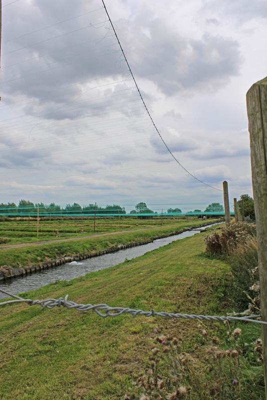
This post brings us to the end of our exploration of the upper reaches of the Driffield Navigation. We left Snakeholm Lock with its endless straight channel and then just as tedium set in the character of the navigation changed. Gone were the high banks and ruler straight lines and it their place came tree lines sweeping bends - much more interesting.

Upstream from Brigham

This "river section" brought us into the hamlet of Brigham, complete with its brand spanking new swing bridge. This is also the main mooring site in the area for small pleasure cruisers and the local sailing club with their distinctive punt like boats which race each Sunday on the two mile pound downstream.

Moorings downstream from Brigham

As we had pretty much run out of drinking water I wandered off up the lane to where a cottage was being rebuilt and, finding a standpipe in the garden, begged a couple of pints. I got talking and discovered that there is a bit of a tale to the bridge, which was installed at great expense in 2003. The bridge replaced a fixed bridge with replaced the older swivel bridge in 1970. The new bridge was built and located on its swivel only for one of the locals to stride up armed with a tape measure and declare that it was too narrow to accommodate the combine harvester. 

Thinking caps were applied and the sides were removed and then splayed out on six inch cantilevers on each side which provided the necessary clearance - just! 
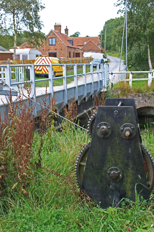
Brigham's new swingbridge

After the reinstatement of a swing bridge at Brigham and the refurbishment of Wansford Lock the restoration team must have felt that they were on the home straight. The project is oh so nearly there with just Wansford Bridge standing between the boats and Riverhead - I am sure it will get there in the end.

Canalside cottages

Downstream there are more non tidal waters to explore - a couple of miles to Struncheon Hill Lock, a mile or so up Frodingham Beck and a couple of miles up West Beck. Plenty to explore another time and a decent gravel slipway at Brigham - perfect for kayaks or trailboats.

Of course, even when fully restored, accessing this lovely little navigation will be a challenge. I know some narrowboats have made the tricky Humber crossing, but its not a route for the faint hearted. 

You can find a short history and contact details re navigating this waterway here.

In the words of Arnie - "I'll be back".

Monday, 7 November 2011

Driffield Navigation by kayak - Snakeholm Lock

Driffield Navigation by Kayak - Part 7
Snakeholm Lock
August 2011

The navigation runs straight and true from Trout Inn to Snakeholm Lock, one of only two navigable locks on the currently accessible route. 


Upstream from Snakeholm Lock at the trout farm inlet

The trout farm is located to the north of the lock, drawing all the flow of water out of the channel and passing it through their many lakes and ponds. The pound is kept low and exiting the kayaks is on the south bank, via the dry bywash channel.

Snakeholm Lock standing open and ready

This lock is interesting in that immediately below the current chamber, restored in 2003, there are another set of gate recesses which date from the days when this was the head of the Tidal River Hull. It appears that before Struncheon Lock was built in the mid 1880's the incoming tides often failed to offer enough water to get boats over the cill of Snakeholm. To remedy this a small lower lock was built, effectively creating a staircase pair to raise boats the few inches needed to access the main upper lock. Its got to be the strangest staircase I have ever seen.  Today the recesses lie empty, but the gate hoops make useful hand grips and double up as mooring points for the few boats which cruise to this point for a quiet night.

Snakeholm Sea Lock

The channel is remorselessly straight below the lock stretching on for nearly a mile before the tedium is broken by a bend. But there is one distinctive feature all kayaker's should be aware of: the return of the water to the river from the trout farm. It sluices in ferociously at a 90 degree angle to the channel, sending a torrent into the side of the kayak before scouring away the bank on the far side. I opted for a stylish ferry glide which nearly saw my tip over, much to Jeff's amusement, whereas he took the more prudent approach of easing along close to the far bank and so avoiding the worst of the rapids.

Downstream from Snakeholm Lock

This section is perhaps the dullest of the route, ok on a fine day but less inviting in a cold windswept afternoon with rain spitting in your face. But don't give up, things soon take a turn for the better.

Sunday, 6 November 2011

Driffield Navigation by kayak Trout Inn and Wansford Bridge

Driffield Navigation - Part 6
Trout Inn and Wansford Bridge
August 2011

I wanted a pub and when I found one it was closed!


Trout Inn - Wansford

The Trout Inn at Wansford marks the current head of navigation, with further progress impeded by the low Wansford Bridge. The locals tell me that funds were earmarked for its replacement with a swing bridge, but this significant step fell foul of the economic situation and funding was withdrawn. This is a shame, but canal restoration is a long game and one has to take these setbacks on your stride. 

The Wansford obstruction

The bridge may be low, but its still ok for kayaks.

Just below the bridge there is the head of navigation mooring, a floating pontoon that looks like it has seen more seasons than boats! There is no winding hole above it so unless you have a very short boat (which most are hereabouts) it will be a very long reverse out.

Trout Inn mooring pontoon

The Trout Inn is aptly named. The parallel river is one of the most sought after trout waters in the country - with fancy fees to match. Think twice before deciding on a round trip using the river to descend. It is private water and best left alone. Just below the Trout Inn there is a vast trout farm, acre upon acre of bubbling lakes, teeming with fish. 

Part of the Trout Farm

I guess the area is naturally good for trout but the stock is clearly topped by artificial means. 

Saturday, 5 November 2011

Driffield Navigation by kayak - Wansford

Driffield Navigation - Part 5
Wansford
August 2011

We had made a late start and arrived at Wansford Lock in need of some lunch. The trouble with Kayaks is that when you are strapped in with a spray deck, accessing essentials like food, drink and yes, my trusty camera is all a bit difficult and best left for a time when we are out of the boats anyway.

Upstream from Wansford Lock

I had been making wild and unsubstantiated promises of a picnic Nirvana at Wansford to Jeff for the last mile or so, so imaging my surprise when lo and behold there set up and ready was a picnic table - right beside the lock. The only thing missing was a pub, but entering one complete with buoyancy aid and spray deck might have raised a few eye brows. 

Calder and Hebble'esque paddle gear - handspike not included

Wansford Lock was full, and replete with brand new gates - the top ones even opened - a feature we made use on on our way back. It was restored in 2009 /10 but cant be used because of the still to be altered Wansford Bridge just downstream.

Downstream

We set about our lunch with a passion of hungry men, passing the time of day with various people who wandered by. It seems that they dont see a lot of canoes or kayaks on these waters. An observation reinforced by the absence of clearly defined landing points. Speaking of which,  the one downstream of the lock is a complete nightmare. Not only is the old quayside high, the water level has been lowered by a couple of feet which made for a perilous 4ft step down into the kayaks. Not bad for a canoe but a real challenge for an overweight 50 year old with one eye on his camera! 

Wansford Lock bottom gates

Jeff was first down and confirmed that he could clamber out  again on the return, so I eased myself into the small cockpit and away we went, past a converted mill and down a stream full of pike, big ones little Jack ones - loads of them in all shapes and sizes.

Friday, 4 November 2011

Driffield Navigation by kayak - Whinhill Lock

Driffield Navigation (part 4)
Whinhill Lock
August 2011


After a longish slog through heavy surface weed we arrived at Whinhill Lock, repaired with new gates but obstructed by a fixed bridge over the chamber itself which gives access to the farm beyond.


Whinhill Lock top gates

The lock is a grade 2 listed structure and has been the focus of restoration work for many years. A lottery grant was finally won in 2004 at which time it was regated and restored to full working order.


This lock has a good set of interpretation boards which give an overview of the navigation's history. It is apparent that the navigation was used by Keels who sailed as much as they could and whose tall masts meant that swing bridges were the order of the day. This fixed bridge will need to be replaced, possibly by a fixed bridge at the lock tail as seen elsewhere. I noticed a strange thing about these locks, the top gates are significantly narrower than the lock chambers, which is odd, and the cills must be a good 20ft long. I'm sure there is a reason but I have no idea what.

How the navigation used to look.

Access at the top is easy, stepping in and out at the weir, but the bottom is another matter. If is was in a canoe (rather than a kayak) I might be tempted to lower it into the lock empty lock chamber and climb down the ladder but that's not possible for us so we had to find an alternative.

 Whinhill Lock bottom gates closed, and open

The bank below the lock is steep and covered with stinging nettles which was a problem. Maybe 200ft down the bank the stingers were less and we dragged the kayaks down to a small sandbagged edge which offered a good place to get in and out.

From there the navigation runs through a wooded cutting, with a few fallen trees being a bit of an obstacle, but not insurmountable. The water is clear and deep supporting all kinds of wildlife. I was particularly struck by the Kingfishers. We must have seen three pairs flitting to in front of us, with the Heron making more sedate progress as it flew from branch to branch, all the time keeping a beady eye out for fish dashing out of our path.

Thursday, 3 November 2011

Driffield Navigation by kayak - Town Lock

Driffield Navigation (part 3)
Town (or Top) Lock
August 2011

No sooner are you afloat than you are climbing out again. The summit pound is maybe a quarter of a mile long and then you are faced with the inoperable town lock. It has been partially restored at some point, but for now it is only sound enough to maintiain a full pound of water above, but wouldn't cope with boater operation.

Town Lock leading to summit pound

The towpath is on the town side but this has been built on, and the lockside incorporated into a garden. We therefore portaged round the other side, walking over a field in search of somewhere to get back in. The lock tail is down a steep and overgrown bank and inaccessible to canoeists.

Town Lock top gates

The best option we could find is at a concrete sewage outfall point a couple of hundred yards downstream (yeh, I know - lovely!). There was a narrow path down a steep bank and then we launched the kayaks off a submerged concrete shelf which forms part of the outfall. Watch out - the steel edge stands proud of the concrete and will scratch your boat if that matters to you.

Downstream from Town Lock

From there the canal runs fairly straight in a shallow cutting between hedges, the watercourse varying in depth and speed which spells of floating weed which worsens as you approach Whinhill Lock. 

There is a family of swans on this reach who are not used to canoes. Mum and Dad let us past after a bit of posturing but the six cygnets were stupid in the extreme, paddling and paddling away from us until, one by one, they crashed away into the reedy margins exhausted and frightened. They wern't the only ones that were knackered - we had been paddling hard and steady for ages, all the time waiting for a flap, flap, flap from behind marking the return of a protective father.

Wednesday, 2 November 2011

Driffield Navigation by kayak - Riverhead

Driffield Navigation by kayak (part 2)
Riverhead, Driffield
August 2011

You couldn't hope for a prettier head of navigation than Riverhead in Driffield. The top pound is surrounded with old mills and warehouses, some converted into housing and some still operating. To say it has atmosphere is an understatement and what a perfect mooring if only boats could get there.

Driffield, Rivehead Mills

The council has made a feature of the area, which has included the restoration of two rather lovely old cranes which fit in so well against the soundtrack of a working grain mill. This place looks right, smells right and sounds right. All in all a heady mix for a canal buff.

Dont take my word for it - look at the pictures:


Bradshaw and Sons Ltd

Mortimers warehouse - any relation Bones?

 Waterside cranes


Access to the navigation is via a slipway which runs from the hard standing in from of Mortimers working grain mill, with plenty of parking along the road. You can just see the slipway in the extreme left of the following photo.


The mills at Riverhead

Tuesday, 1 November 2011

Driffield Navigation by kayak - introduction

Driffield Navigation 
Introduction
August 2011


A visit to Humberside with Belle and Jeff presented an opportunity to go exploring on the Saturday, but where to go? I have had a look at the bottom half of the Market Weighton Canal, but looking at the map the upper end isn't too inspirational, certainly not for a whole day.

Riverhead - start of the Navigation

Then I remembered the Driffield Navigation, the extension to the River Hull which allowed 60 ton Keels to reach the mills at Riverhead, Driffield. Its not too far from Hull and perfect for a trip in our underused kayaks. They were duly loaded into the roof rack and off we went. 

The Driffield Navigation is perfect for Kayaks and Canoes, a waterway on which the right of navigation has never been repealed, punctuated by a series of locks (restored and unrestored) leading down the the navigable reaches at Brigham. Perfect, but not always easy!

Map of the Driffield Navigation
Our trip took us from 1 to 11 (and back).

In total the navigation is 11 miles long with five locks stretching to the tidal River Hull but this expedition covered the top half, which is mostly above the low Wansford Bridge (8) which is the single remaining obstacle obstructing this canal.

This will be a series of pictorial posts with limited commentary, mostly relating to the waterway from a canoeist's perspective.

Posts in this series:

1. Introduction - this post