Ogley Locks - Boat Bridge
January 2013
After losing access from the line of the canal at the quarry to the east of the aqueduct we pick it up again at Boat Bridge, just behind The Boat pub.
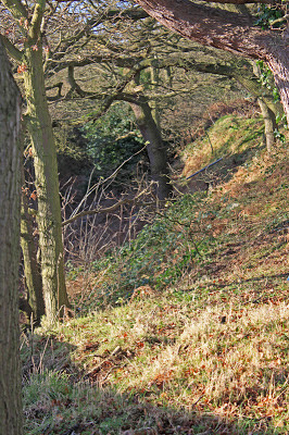
Whilst I couldn't access the cutting behind the pub, a bit of scrambling along the road verge I was able to grab a view of the dry cutting heading north under the trees.
Dry channel to the north of The Bridge.
But that wasn't all I saw when I poked my head over the fence. The new road has obliterated the old road bridge but there beneath me was a huge water pipe, cranked up into a classic pipe bridge over the remnant of the canal channel. My angle on the pipe was lousy, but I think you will get the idea. There also appears to the a bit of old bridge parapet in the undergrowth, but without being able to get close I cant be sure.
The remaining pipe bridge
To overcome the obstacle of the new road the plan is to insert an extra lock just to the north and thus gain the headroom needed.
The route on the other side of the Shire Oak / Muckley Corner Road is not very clear. However, a road called Boat Lane is something of a give away and faithfully follows the lone of the canal round to Watling Street with, as far as I can tell, the in filled route lying immediately to the north of the lane.


5 comments:
Captain I've just stumbled on this web site, link below, which allows you to overlay Google maps over the old 1921 os map. It gives a pretty accurate view of now and then in the same scale. Have a play with it, I have and it's pretty good at giving the exact line of long gone features, canals roads etc.
http://www.ponies.me.uk/maps/osmap.html
Hi again Captain
I too traced the route as best I could of the W&E from Ogley into Lichfield last Feb.The remains of lock 5 at Barracks Lane were a highlight, as was the infilled bridge just past Muckley Corner island. At Coppice Lane you can see the huge stones of a lock and a small pipe bridge where the canal once went under the road. I had a few funny stares here taking pictures as some locals were driving past! At Pipehill Bridge you can still make out the brick edges of the canal...I'm not sure if its possible to clamber down here...or even to go along the disused railway line from Fosseway Lane level crossing. I presume as canal and railway share the same bridge at Pipehill that access to the canalbed would be possible?
I gather also there is an excavated lock off Fosseway Lane which is accessible, but I somehow missed this.
Thanks for the always interesting posts !
Best regards, Craig
Thanks Dave - I will give it a look.
Craig- I cant believe I missed lock 5! As for the Pipehill area - watch this space... Let me know if I missed anything you found. Andy
Andy - I've just had a look at the website Dave Howse mentioned. It's good and very easy to use, although the "transparency fader" acts like an on/off switch and not a fader. But it might be me.
The Trust is not working on Lock five, it's the landowner creating a new access next to the lock. Nick's Canal Planner is a good indication of the current line of restoration as I update any changes.
Stefan
LHCRT Magazine Editor
Post a Comment