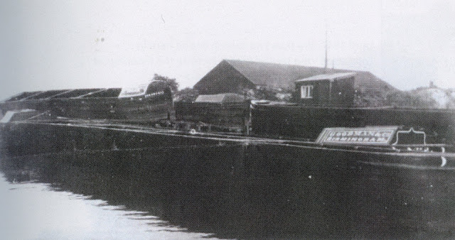
Strictly speaking Anglesey Basin remains navigable, but the short branch from Catshill Junction in Brownhills has such a rich lost heritage I cant resist including a page dedicated to images of the old coal loading infrastructure.
The channel was first built in 1800 to carry water from what is now known the Chasewater Reservoir to the Wyrley and Essington Canal. Later in 1850 the channel was enlarged to full navigable dimensions to facilitate access to the new collieries being sunk in the lee of the reservoir dam wall.
The coal trade continued from this wharf to the very end of canal carrying, only coming to an end in 1967.
Before the construction of the M6 Toll this was a magical place to moor but these days the combined rumble of the M6 Toll and its cousin the A5 are always audible, dispelling some of the mysterious atmosphere which hangs over the site.
Probably the best picture of the 1930's old loading canopy at Anglesey Basin
1960's loading conveyor with Juniper Cottage in background
Coal Chutes 1951
Moving coal from Anglesey Basin in the 1950's
Element's Princess Anne returning to Anglesey Basin in 1955 Bob May Collection (BCNS Archive)
Black Cock Bridge - Ian Husselbee (RCHS archive)
Breach Gates at Northywood Bridge (aka Horners Bridge) Aldridge 1934

Coal on Daw End Branch taken from Riddian Bridge in1966: Charlie, Horace and Young Billy Foster carry small coal for GEC Witton on Princess Anne and two joeys

Coal on Daw End Branch taken from Riddian Bridge in1966: Charlie, Horace and Young Billy Foster carry small coal for GEC Witton on Princess Anne and two joeys
Andy Matthews comments on above image 26.1.25 :
Charlie on Princess Ann, Horace on the middle joey with Billy steering the trailer, they have just passed under Riddean bridge heading to GEC witton with three loads of slack (very small coal) it would be unloaded by the telfer crane there, PA first with the now empty tug grabbing a couple of empties for the journey back leaving the full joeys in their place.
They were working for T&S Elements at this time, Elements having the contract to supply GEC with boiler coal. They originally loaded at Hednesford and could do 6 trips a week, once the extension closed as a result of subsidence and the open cast works they loaded at Holly bonk or Lane Head basin then finally at Anglesey basin after Lane Head stopped loading.
Charles Foster at Longwood Top Lock 1966 - Source Andy Matthews
Andy Matthews recollections of the above image 26.1.25:
The picture of Longwood top with the lockies vegetable patch on the offside is Charles Foster using a shaft to pull one of the two joeys he was towing behind Princess Anne into the lock, this was repeated at every lock in the flight, man power being used with P.A being locked through the flight first, there were three guys on this trip, Charlie, Horace his son and Young Billy his nephew.
The above photos have been assembled from various sources, including those freely found on the internet. My thanks go to the many photographers alive and dead who have contributed to this collection and in so doing, are keeping the memory of these lost canals alive. These images are reproduced for ease of research are are not necessarily the property of this blog, and as such should not be used for commercial gain without the explicit permission of the owner (whoever that may be).


